Boucle de Damré 8 Km

Efr
User
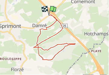

Length
8.3 km

Max alt
315 m

Uphill gradient
148 m
Km-Effort
10.2 km

Min alt
233 m

Downhill gradient
148 m
Boucle
Yes
Creation date :
2021-03-06 19:47:40.185
Updated on :
2021-03-07 20:08:56.204
--
Difficulty : Easy

FREE GPS app for hiking
 SityTrail
IGN / Geographical institutes
SityTrail Plus
The world is yours!
About
Trail On foot of 8.3 km to be discovered at Wallonia, Liège, Sprimont. This trail is proposed by Efr.
Description
Départ: Parking Sortie E25 Sprimont
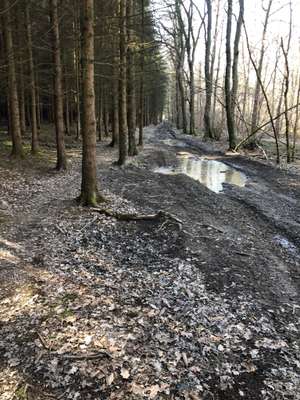
Photos


Positioning
Country:
Belgium
Region :
Wallonia
Department/Province :
Liège
Municipality :
Sprimont
Location:
Sprimont
Start:(Dec)
Start:(UTM)
690291 ; 5598686 (31U) N.
Comments