


Mont verdun

jpfrobert
User
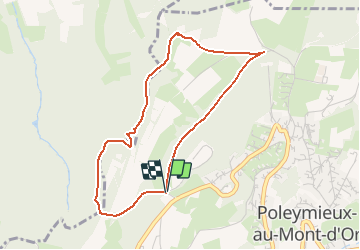

Length
3.9 km

Max alt
539 m

Uphill gradient
130 m
Km-Effort
5.7 km

Min alt
407 m

Downhill gradient
138 m
Boucle
Yes
Creation date :
2021-03-07 13:03:01.742
Updated on :
2021-03-07 13:03:32.486
1h17
Difficulty : Easy

FREE GPS app for hiking
 SityTrail
IGN / Geographical institutes
SityTrail Plus
The world is yours!
About
Trail Walking of 3.9 km to be discovered at Auvergne-Rhône-Alpes, Métropole de Lyon, Poleymieux-au-Mont-d'Or. This trail is proposed by jpfrobert.
Positioning
Country:
France
Region :
Auvergne-Rhône-Alpes
Department/Province :
Métropole de Lyon
Municipality :
Poleymieux-au-Mont-d'Or
Location:
Unknown
Start:(Dec)
Start:(UTM)
638811 ; 5079856 (31T) N.
Comments