


Montfort sur Meu

nolsim
User
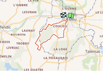

Length
10.2 km

Max alt
131 m

Uphill gradient
124 m
Km-Effort
11.9 km

Min alt
40 m

Downhill gradient
126 m
Boucle
Yes
Creation date :
2021-03-08 12:53:48.74
Updated on :
2021-03-08 15:13:15.329
2h04
Difficulty : Very easy

FREE GPS app for hiking
 SityTrail
IGN / Geographical institutes
SityTrail Plus
The world is yours!
About
Trail Walking of 10.2 km to be discovered at Brittany, Ille-et-Vilaine, Montfort-sur-Meu. This trail is proposed by nolsim.
Positioning
Country:
France
Region :
Brittany
Department/Province :
Ille-et-Vilaine
Municipality :
Montfort-sur-Meu
Location:
Unknown
Start:(Dec)
Start:(UTM)
577512 ; 5331616 (30U) N.
Comments