


arsel la grotte aux fees

labarone
User
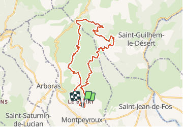

Length
20 km

Max alt
561 m

Uphill gradient
703 m
Km-Effort
29 km

Min alt
133 m

Downhill gradient
704 m
Boucle
Yes
Creation date :
2021-03-09 08:01:53.733
Updated on :
2021-03-09 15:07:21.185
4h58
Difficulty : Medium

FREE GPS app for hiking
 SityTrail
IGN / Geographical institutes
SityTrail Plus
The world is yours!
About
Trail Walking of 20 km to be discovered at Occitania, Hérault, Montpeyroux. This trail is proposed by labarone.
Description
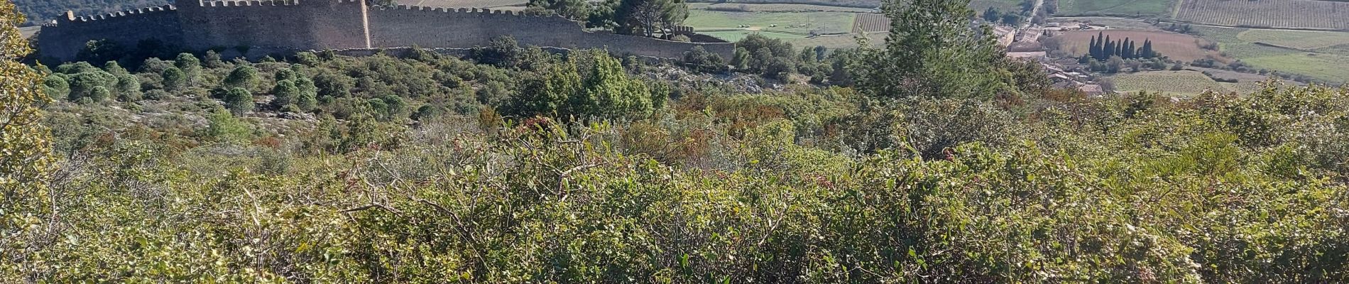
belle rando
belles vues
terrains des sentiers differents les uns des autres
Photos


Positioning
Country:
France
Region :
Occitania
Department/Province :
Hérault
Municipality :
Montpeyroux
Location:
Unknown
Start:(Dec)
Start:(UTM)
541021 ; 4838714 (31T) N.
Comments