La ronde de Lans

crocau
User
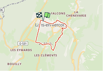

Length
5.5 km

Max alt
1124 m

Uphill gradient
140 m
Km-Effort
7.4 km

Min alt
995 m

Downhill gradient
137 m
Boucle
Yes
Creation date :
2021-03-13 14:52:16.77
Updated on :
2021-03-13 16:26:07.339
1h27
Difficulty : Very easy

FREE GPS app for hiking
 SityTrail
IGN / Geographical institutes
SityTrail Plus
The world is yours!
About
Trail Walking of 5.5 km to be discovered at Auvergne-Rhône-Alpes, Isère, Lans-en-Vercors. This trail is proposed by crocau.
Description
D'après les sentiers d'Émile
Photos


Positioning
Country:
France
Region :
Auvergne-Rhône-Alpes
Department/Province :
Isère
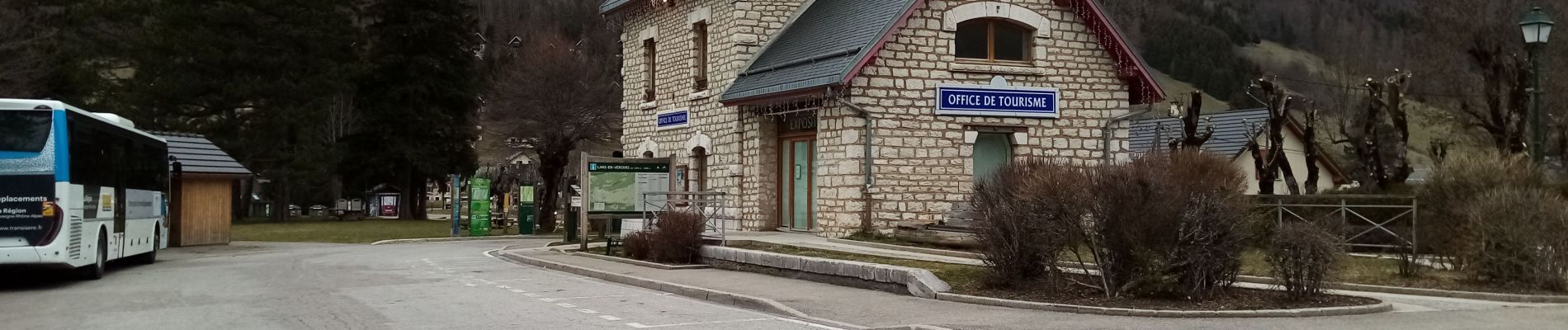
Municipality :
Lans-en-Vercors
Location:
Unknown
Start:(Dec)
Start:(UTM)
703265 ; 5000555 (31T) N.
Comments