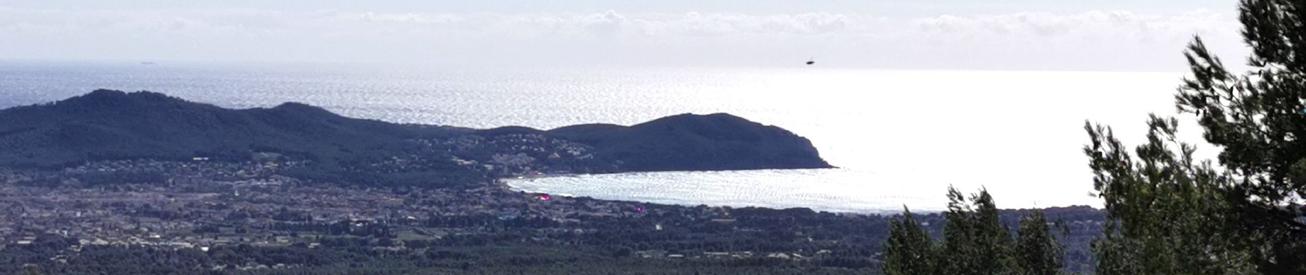
Grand Caunet, télégraphe, revers du Bosquié

Daniel.BRUN-PICARD
User
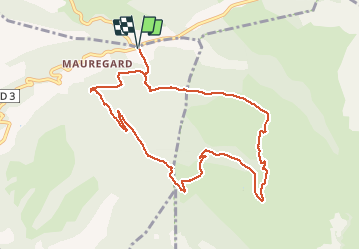

Length
10.7 km

Max alt
465 m

Uphill gradient
341 m
Km-Effort
15.2 km

Min alt
202 m

Downhill gradient
340 m
Boucle
Yes
Creation date :
2021-03-14 08:37:25.37
Updated on :
2021-05-02 17:49:10.81
4h00
Difficulty : Easy

FREE GPS app for hiking
 SityTrail
IGN / Geographical institutes
SityTrail Plus
The world is yours!
About
Trail Walking of 10.7 km to be discovered at Provence-Alpes-Côte d'Azur, Bouches-du-Rhône, Ceyreste. This trail is proposed by Daniel.BRUN-PICARD.
Photos


Positioning
Country:
France
Region :
Provence-Alpes-Côte d'Azur
Department/Province :
Bouches-du-Rhône
Municipality :
Ceyreste
Location:
Unknown
Start:(Dec)
Start:(UTM)
716974 ; 4790308 (31T) N.
Comments