


la casquette de charlemagne de jacqueline

Coryphene
User
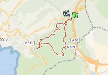

Length
7.6 km

Max alt
333 m

Uphill gradient
312 m
Km-Effort
11.8 km

Min alt
142 m

Downhill gradient
316 m
Boucle
Yes
Creation date :
2021-03-18 08:50:53.649
Updated on :
2021-03-18 17:04:14.839
2h39
Difficulty : Easy

FREE GPS app for hiking
 SityTrail
IGN / Geographical institutes
SityTrail Plus
The world is yours!
About
Trail Walking of 7.6 km to be discovered at Provence-Alpes-Côte d'Azur, Bouches-du-Rhône, Cassis. This trail is proposed by Coryphene.
Description
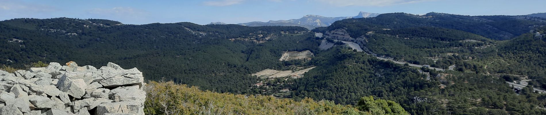
une belle randonnée sur les hauteurs de Cassis et une vue splendide sur la ville et aussi la baie de laciotat
Photos


Positioning
Country:
France
Region :
Provence-Alpes-Côte d'Azur
Department/Province :
Bouches-du-Rhône
Municipality :
Cassis
Location:
Unknown
Start:(Dec)
Start:(UTM)
709514 ; 4788595 (31T) N.
Comments