


rochecolombe

raab
User
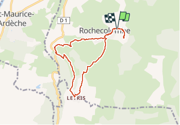

Length
7.9 km

Max alt
312 m

Uphill gradient
181 m
Km-Effort
10.3 km

Min alt
191 m

Downhill gradient
183 m
Boucle
Yes
Creation date :
2021-03-18 13:24:23.249
Updated on :
2021-03-18 18:03:38.978
2h49
Difficulty : Medium

FREE GPS app for hiking
 SityTrail
IGN / Geographical institutes
SityTrail Plus
The world is yours!
About
Trail Walking of 7.9 km to be discovered at Auvergne-Rhône-Alpes, Ardèche, Rochecolombe. This trail is proposed by raab.
Positioning
Country:
France
Region :
Auvergne-Rhône-Alpes
Department/Province :
Ardèche
Municipality :
Rochecolombe
Location:
Unknown
Start:(Dec)
Start:(UTM)
614207 ; 4930570 (31T) N.
Comments