Trail Walking Murol - Le tour de Beaune le froid  - Photo

Le tour de Beaune le froid

© OpenStreetMap contributors
Length
Length
19 km
Max alt
Max alt
1378 m
Uphill gradient
Uphill gradient
532 m
Km-Effort
Km-Effort  
26 km
Min alt
Min alt
1036 m
Downhill gradient
Downhill gradient
532 m
Boucle
Boucle
Yes
Creation date :
2021-03-19 07:38:40.0
Updated on :
2021-03-19 15:34:04.115

(0 Reviews)

Walking
Walking
7h37
Difficulty : Easy

Scan this QR Code to open this trail in the SityTrail application

FREE GPS app for hiking

Logo SityTrail SityTrail

IGN / Geographical institutes

Download SityTrail from the App Store Download SityTrail from Google Play

Logo SityTrail SityTrail World

The world is yours!

Download SityTrail from the App Store Download SityTrail from Google Play Download SityTrail on Huawei AppGallery

About

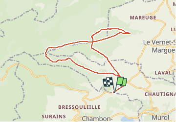
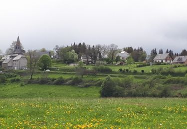
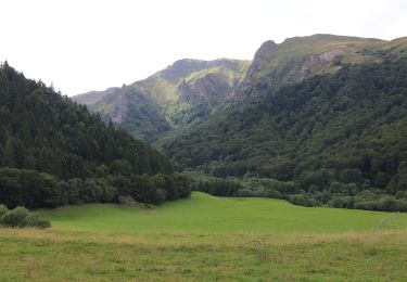
Trail Walking of 19 km to be discovered at Auvergne-Rhône-Alpes, Puy-de-Dôme, Murol. This trail is proposed by zefreefly.

Description

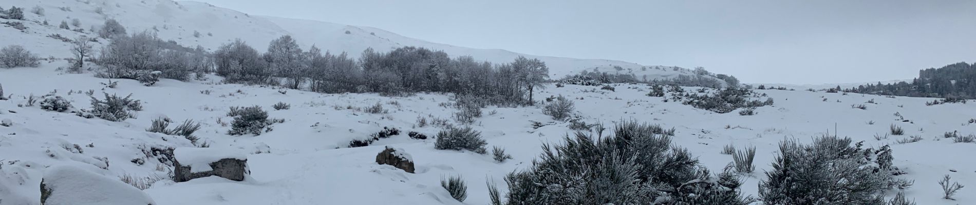
Belle balade Buron et paysage, fait en hiver raquette et marche avec 10 cm de neige magique.
Avec la neige deux passage sans balisage n’y chemin visible. Mais la trace est ok.

Elevation profile

Photos

Positioning

Country:
France
Region :
Auvergne-Rhône-Alpes
Department/Province :
Puy-de-Dôme
Municipality :
Murol
Location:
Unknown
Start:(UTM)
493023 ; 5048066 (31T) N.

Trails nearby

Trail Walking Chambon-sur-Lac - Chambon_Couze_Surains - Photo
Walking
GUIDE
jagarnier

Walking

Medium
(1)
Chambon-sur-Lac, Auvergne-Rhône-Alpes, Puy-de-Dôme, France
11.4 km | 16.6 km-effort
3h 30min
Yes
Trail Walking Le Vernet-Sainte-Marguerite - Vernet_Puy_Alou - Photo
Walking
GUIDE
jagarnier

Walking

Medium
(1)
Le Vernet-Sainte-Marguerite, Auvergne-Rhône-Alpes, Puy-de-Dôme, France
9.9 km | 13.1 km-effort
2h 50min
Yes
Trail Walking Saint-Victor-la-Rivière - St_Victor_Foret_Courbanges - Photo
Walking
GUIDE
jagarnier

Walking

Medium
(1)
Saint-Victor-la-Rivière, Auvergne-Rhône-Alpes, Puy-de-Dôme, France
10.3 km | 14.8 km-effort
3h 0min
Yes
Trail Walking Murol - Lac Chambon et château médiéval de Murol - Photo
Walking
tracegps

Walking

Medium
(4)
Murol, Auvergne-Rhône-Alpes, Puy-de-Dôme, France
8.9 km | 13.4 km-effort
2h 15min
Yes
Trail Walking Murol - Murol_Marais_Chambon - Photo
Walking
GUIDE
jagarnier

Walking

Medium
(1)
Murol, Auvergne-Rhône-Alpes, Puy-de-Dôme, France
7 km | 10.9 km-effort
2h 0min
Yes
Trail On foot Chambon-sur-Lac - Voissière - Photo
On foot
PRO

On foot

Easy
Chambon-sur-Lac, Auvergne-Rhône-Alpes, Puy-de-Dôme, France
9.4 km | 15 km-effort
3h 24min
Yes
Trail On foot Saint-Victor-la-Rivière - Roche-Romaine - Photo
On foot
PRO

On foot

Easy
Saint-Victor-la-Rivière, Auvergne-Rhône-Alpes, Puy-de-Dôme, France
10.1 km | 13.8 km-effort
3h 7min
Yes
Trail On foot Le Vernet-Sainte-Marguerite - Le Puy d'Alou - Photo
On foot
PRO

On foot

Easy
Le Vernet-Sainte-Marguerite, Auvergne-Rhône-Alpes, Puy-de-Dôme, France
9.3 km | 12 km-effort
2h 43min
Yes
Trail On foot Chambon-sur-Lac - La Vallée de Chaudefour - Photo
On foot
PRO

On foot

Medium
Chambon-sur-Lac, Auvergne-Rhône-Alpes, Puy-de-Dôme, France
14.8 km | 26 km-effort
5h 56min
Yes


Close
My subscriptions