


Saint fortunat

raygautier
User

Length
6.1 km

Max alt
644 m

Uphill gradient
27 m
Km-Effort
8.2 km

Min alt
139 m

Downhill gradient
527 m
Boucle
No
Creation date :
2021-03-21 12:33:04.0
Updated on :
2021-03-21 15:11:15.137
2h07
Difficulty : Unknown

FREE GPS app for hiking
 SityTrail
IGN / Geographical institutes
SityTrail Plus
The world is yours!
About
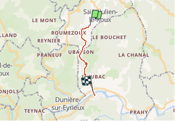
Trail Walking of 6.1 km to be discovered at Auvergne-Rhône-Alpes, Ardèche, Saint-Julien-le-Roux. This trail is proposed by raygautier.
Positioning
Country:
France
Region :
Auvergne-Rhône-Alpes
Department/Province :
Ardèche
Municipality :
Saint-Julien-le-Roux
Location:
Unknown
Start:(Dec)
Start:(UTM)
632277 ; 4968964 (31T) N.
Comments