


Mirabel et Balcons de La Drôme 18km

thonyc
User GUIDE
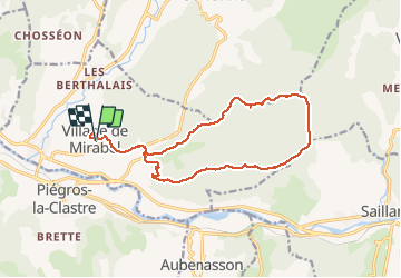

Length
17.7 km

Max alt
670 m

Uphill gradient
626 m
Km-Effort
26 km

Min alt
254 m

Downhill gradient
632 m
Boucle
Yes
Creation date :
2021-03-21 12:33:47.706
Updated on :
2024-09-27 13:12:49.132
5h55
Difficulty : Very difficult

FREE GPS app for hiking
 SityTrail
IGN / Geographical institutes
SityTrail Plus
The world is yours!
About
Trail Walking of 17.7 km to be discovered at Auvergne-Rhône-Alpes, Drôme, Mirabel-et-Blacons. This trail is proposed by thonyc.
Description
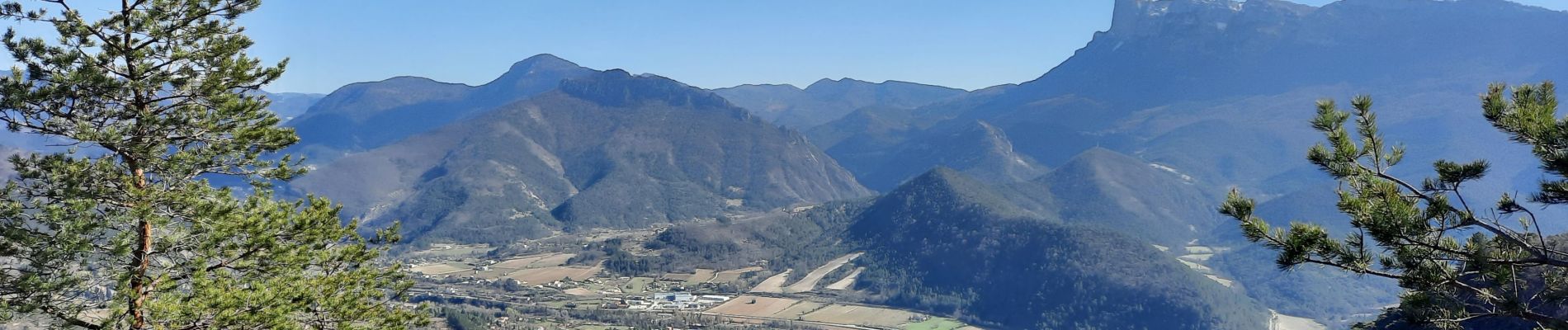
Belle restauration du village avec de beaux panoramas
Rando tranquille offant de belles vues sur le synclinal de Saoû
Photos


Positioning
Country:
France
Region :
Auvergne-Rhône-Alpes
Department/Province :
Drôme
Municipality :
Mirabel-et-Blacons
Location:
Unknown
Start:(Dec)
Start:(UTM)
666800 ; 4953357 (31T) N.
Comments