


Arbin-Cruet-2021-03-23

Valmeinier
User
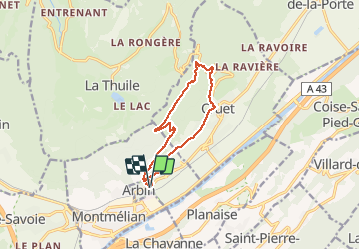

Length
11.1 km

Max alt
855 m

Uphill gradient
628 m
Km-Effort
19.5 km

Min alt
294 m

Downhill gradient
628 m
Boucle
Yes
Creation date :
2021-03-24 06:24:02.376
Updated on :
2021-03-24 07:16:31.27
4h25
Difficulty : Medium

FREE GPS app for hiking
 SityTrail
IGN / Geographical institutes
SityTrail Plus
The world is yours!
About
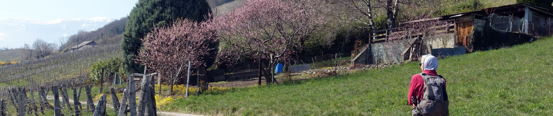
Trail Walking of 11.1 km to be discovered at Auvergne-Rhône-Alpes, Savoy, Arbin. This trail is proposed by Valmeinier.
Photos


Positioning
Country:
France
Region :
Auvergne-Rhône-Alpes
Department/Province :
Savoy
Municipality :
Arbin
Location:
Unknown
Start:(Dec)
Start:(UTM)
270981 ; 5043629 (32T) N.
Comments