


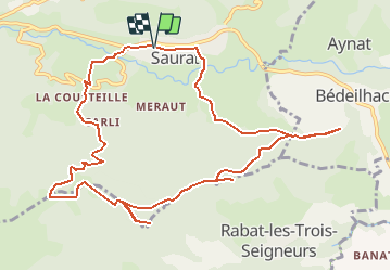
Sommet du Mont et Roche Ronde depuis Saurat

c.chehere
User

Length
13.1 km

Max alt
1181 m

Uphill gradient
720 m
Km-Effort
23 km

Min alt
637 m

Downhill gradient
720 m
Boucle
Yes
Creation date :
2021-03-24 09:04:25.832
Updated on :
2021-03-28 06:44:31.536
5h10
Difficulty : Very difficult

FREE GPS app for hiking
 SityTrail
IGN / Geographical institutes
SityTrail Plus
The world is yours!
About
Trail Walking of 13.1 km to be discovered at Occitania, Ariège, Saurat. This trail is proposed by c.chehere.
Positioning
Country:
France
Region :
Occitania
Department/Province :
Ariège
Municipality :
Saurat
Location:
Unknown
Start:(Dec)
Start:(UTM)
380191 ; 4748298 (31T) N.
Comments