


Longpont-sur-Orge_4157471_M

gdela
User
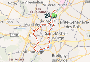

Length
13 km

Max alt
128 m

Uphill gradient
161 m
Km-Effort
15.2 km

Min alt
37 m

Downhill gradient
161 m
Boucle
Yes
Creation date :
2021-03-24 10:45:12.387
Updated on :
2021-03-24 10:48:01.203
3h27
Difficulty : Easy

FREE GPS app for hiking
 SityTrail
IGN / Geographical institutes
SityTrail Plus
The world is yours!
About
Trail On foot of 13 km to be discovered at Ile-de-France, Essonne, Longpont-sur-Orge. This trail is proposed by gdela.
Positioning
Country:
France
Region :
Ile-de-France
Department/Province :
Essonne
Municipality :
Longpont-sur-Orge
Location:
Unknown
Start:(Dec)
Start:(UTM)
448080 ; 5388112 (31U) N.
Comments