


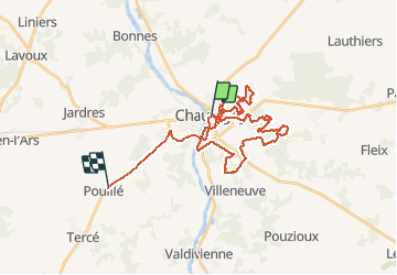
autour de Chauvigny

Arnaud Dejean
User

Length
35 km

Max alt
137 m

Uphill gradient
549 m
Km-Effort
42 km

Min alt
59 m

Downhill gradient
498 m
Boucle
No
Creation date :
2021-03-24 13:21:43.982
Updated on :
2021-03-24 16:31:04.98
3h08
Difficulty : Medium

FREE GPS app for hiking
 SityTrail
IGN / Geographical institutes
SityTrail Plus
The world is yours!
About
Trail Mountain bike of 35 km to be discovered at New Aquitaine, Vienne, Chauvigny. This trail is proposed by Arnaud Dejean.
Positioning
Country:
France
Region :
New Aquitaine
Department/Province :
Vienne
Municipality :
Chauvigny
Location:
Unknown
Start:(Dec)
Start:(UTM)
319430 ; 5159907 (31T) N.
Comments