


Ebreuil. Chemin des renards 🦊

Gegetop
User
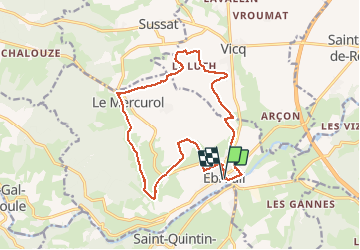

Length
16.9 km

Max alt
473 m

Uphill gradient
322 m
Km-Effort
21 km

Min alt
303 m

Downhill gradient
324 m
Boucle
Yes
Creation date :
2021-03-24 10:47:20.112
Updated on :
2021-03-24 17:16:37.525
3h54
Difficulty : Medium

FREE GPS app for hiking
 SityTrail
IGN / Geographical institutes
SityTrail Plus
The world is yours!
About
Trail Walking of 16.9 km to be discovered at Auvergne-Rhône-Alpes, Allier, Ébreuil. This trail is proposed by Gegetop.
Description
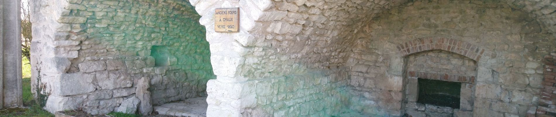
Superbe randonnée offrant de splendides points de vues sur la Limagne.
Photos


Positioning
Country:
France
Region :
Auvergne-Rhône-Alpes
Department/Province :
Allier
Municipality :
Ébreuil
Location:
Unknown
Start:(Dec)
Start:(UTM)
506799 ; 5106893 (31T) N.
Comments