


25 mars

Divio
User
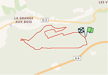

Length
8.9 km

Max alt
257 m

Uphill gradient
152 m
Km-Effort
10.9 km

Min alt
155 m

Downhill gradient
154 m
Boucle
Yes
Creation date :
2021-03-25 07:35:45.186
Updated on :
2021-03-25 10:07:53.191
1h43
Difficulty : Very easy

FREE GPS app for hiking
 SityTrail
IGN / Geographical institutes
SityTrail Plus
The world is yours!
About
Trail Nordic walking of 8.9 km to be discovered at Grand Est, Marne, Sainte-Menehould. This trail is proposed by Divio.
Positioning
Country:
France
Region :
Grand Est
Department/Province :
Marne
Municipality :
Sainte-Menehould
Location:
Unknown
Start:(Dec)
Start:(UTM)
644250 ; 5439864 (31U) N.
Comments