Trail Hybrid bike Dampierre-en-Burly - Samedi 27 mars - Photo
 bibime
bibime

User

© OpenStreetMap contributors
Length
Length
953 m
Max alt
Max alt
152 m
Uphill gradient
Uphill gradient
5 m
Km-Effort
Km-Effort  
1 km
Min alt
Min alt
145 m
Downhill gradient
Downhill gradient
7 m
Boucle
Boucle
No
Creation date :
2021-03-27 07:21:36.0
Updated on :
2021-03-27 08:21:23.936

(0 Reviews)

Hybrid bike
Hybrid bike
57m
Difficulty : Medium

Scan this QR Code to open this trail in the SityTrail application

FREE GPS app for hiking

Logo SityTrail SityTrail

IGN / Geographical institutes

Download SityTrail from the App Store Download SityTrail from Google Play

Logo SityTrail SityTrail World

The world is yours!

Download SityTrail from the App Store Download SityTrail from Google Play Download SityTrail on Huawei AppGallery

About

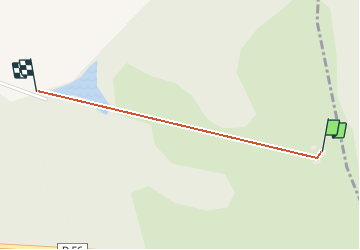
Trail Hybrid bike of 953 m to be discovered at Centre-Loire Valley, Loiret, Dampierre-en-Burly. This trail is proposed by bibime.

Description

Route de la plaine aux cerfs

Elevation profile

Positioning

Country:
France
Region :
Centre-Loire Valley
Department/Province :
Loiret
Municipality :
Dampierre-en-Burly
Location:
Unknown
Start:(UTM)
469975 ; 5291203 (31T) N.

Trails nearby

Trail Walking Le Moulinet-sur-Solin - 1 - Photo
Walking
flosalin

Walking

Easy
Le Moulinet-sur-Solin, Centre-Loire Valley, Loiret, France
3.9 km | 4.4 km-effort
56min
Yes
Trail Walking Nevoy - Rando en forêt  - Photo
Walking
Ordijamo45

Walking

Very easy
Nevoy, Centre-Loire Valley, Loiret, France
8.2 km | 9 km-effort
3h 4min
Yes
Trail Walking Le Moulinet-sur-Solin - Les Choux 45 Forêt 13Km4 - Photo
Walking
picouleau220345

Walking

Easy
Le Moulinet-sur-Solin, Centre-Loire Valley, Loiret, France
13.4 km | 14.9 km-effort
3h 18min
Yes
Trail Walking Dampierre-en-Burly - Dampierre-en-Burly - Photo
Walking
Ordijamo45

Walking

Easy
Dampierre-en-Burly, Centre-Loire Valley, Loiret, France
11.7 km | 12.9 km-effort
2h 52min
Yes
Trail Walking Le Moulinet-sur-Solin - Montereau 1  - Photo
Walking
flosalin

Walking

Easy
Le Moulinet-sur-Solin, Centre-Loire Valley, Loiret, France
4.2 km | 4.8 km-effort
58min
Yes
Trail Walking Le Moulinet-sur-Solin - Montereau  - Photo
Walking
flosalin

Walking

Easy
Le Moulinet-sur-Solin, Centre-Loire Valley, Loiret, France
5.1 km | 5.8 km-effort
1h 8min
Yes
Trail Walking Le Moulinet-sur-Solin - tour Montereau - Photo
Walking
flosalin

Walking

Easy
Le Moulinet-sur-Solin, Centre-Loire Valley, Loiret, France
2.9 km | 3.4 km-effort
38min
Yes
Trail Walking Le Moulinet-sur-Solin - les choux nicole  n - Photo
Walking
picouleau220345

Walking

Difficult
Le Moulinet-sur-Solin, Centre-Loire Valley, Loiret, France
13.8 km | 15.4 km-effort
3h 14min
Yes
Trail Walking Le Moulinet-sur-Solin - les choux Vicky - Photo
Walking
picouleau220345

Walking

Medium
Le Moulinet-sur-Solin, Centre-Loire Valley, Loiret, France
12.6 km | 14 km-effort
2h 42min
Yes


Close
My subscriptions