


tour pedestre

sterdyniak
User
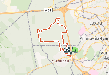

Length
12.7 km

Max alt
366 m

Uphill gradient
203 m
Km-Effort
15.4 km

Min alt
278 m

Downhill gradient
204 m
Boucle
Yes
Creation date :
2021-03-27 07:07:46.677
Updated on :
2021-03-27 08:32:05.738
1h23
Difficulty : Very easy

FREE GPS app for hiking
 SityTrail
IGN / Geographical institutes
SityTrail Plus
The world is yours!
About
Trail Trail of 12.7 km to be discovered at Grand Est, Meurthe-et-Moselle, Villers-lès-Nancy. This trail is proposed by sterdyniak.
Description
trail
Positioning
Country:
France
Region :
Grand Est
Department/Province :
Meurthe-et-Moselle
Municipality :
Villers-lès-Nancy
Location:
Unknown
Start:(Dec)
Start:(UTM)
288226 ; 5393566 (32U) N.
Comments