


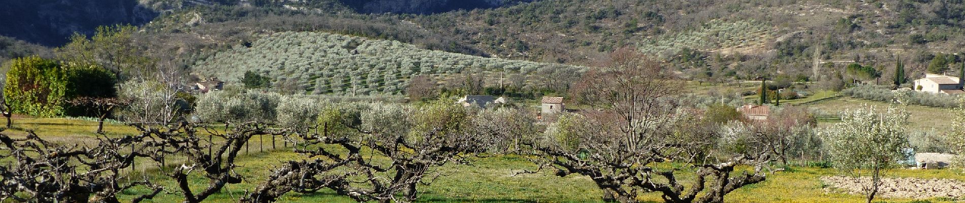
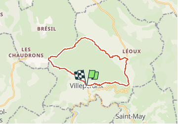
Villeperdrix-L'Angèle 13km

thonyc
User GUIDE

Length
13.5 km

Max alt
1259 m

Uphill gradient
860 m
Km-Effort
25 km

Min alt
461 m

Downhill gradient
864 m
Boucle
Yes
Creation date :
2021-03-30 08:23:21.596
Updated on :
2024-05-16 08:19:08.973
5h44
Difficulty : Difficult

FREE GPS app for hiking
 SityTrail
IGN / Geographical institutes
SityTrail Plus
The world is yours!
About
Trail Walking of 13.5 km to be discovered at Auvergne-Rhône-Alpes, Drôme, Villeperdrix. This trail is proposed by thonyc.
Description
Forte montée et terrain caillouteux classe cette rando comme difficile
Panoramas superbes
Photos


Positioning
Country:
France
Region :
Auvergne-Rhône-Alpes
Department/Province :
Drôme
Municipality :
Villeperdrix
Location:
Unknown
Start:(Dec)
Start:(UTM)
681997 ; 4923471 (31T) N.
Comments