


Fred St Angel

arnoultjf
User
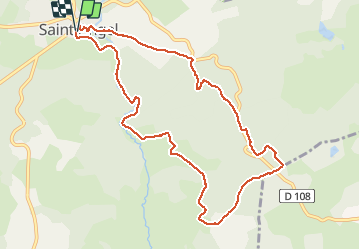

Length
10.5 km

Max alt
737 m

Uphill gradient
238 m
Km-Effort
13.7 km

Min alt
629 m

Downhill gradient
237 m
Boucle
Yes
Creation date :
2021-03-30 11:38:21.714
Updated on :
2021-03-30 15:12:24.795
3h32
Difficulty : Very easy

FREE GPS app for hiking
 SityTrail
IGN / Geographical institutes
SityTrail Plus
The world is yours!
About
Trail Walking of 10.5 km to be discovered at New Aquitaine, Corrèze, Saint-Angel. This trail is proposed by arnoultjf.
Description
Difficulté difficile
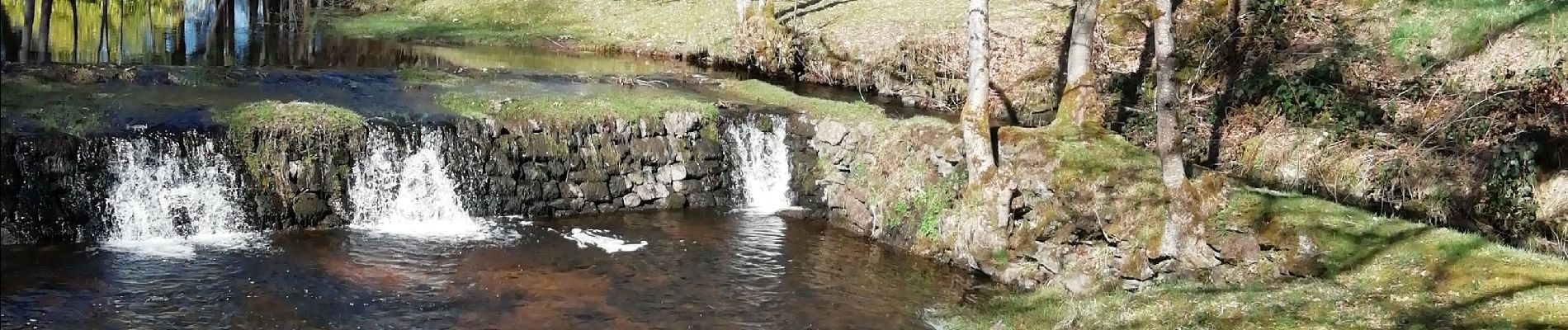
Photos


Positioning
Country:
France
Region :
New Aquitaine
Department/Province :
Corrèze
Municipality :
Saint-Angel
Location:
Unknown
Start:(Dec)
Start:(UTM)
440036 ; 5039066 (31T) N.
Comments