


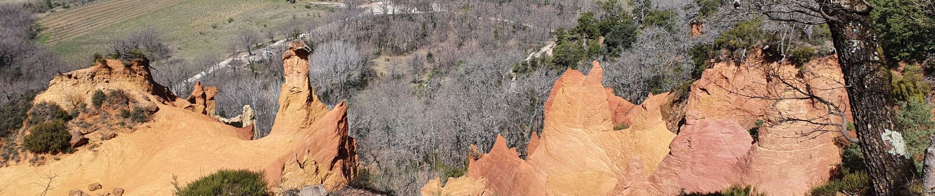
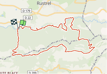
traversée du Colorado en boucle du camping

csy95
User

Length
14.1 km

Max alt
574 m

Uphill gradient
337 m
Km-Effort
18.6 km

Min alt
312 m

Downhill gradient
340 m
Boucle
Yes
Creation date :
2021-04-01 08:11:30.467
Updated on :
2021-04-01 11:48:12.595
3h07
Difficulty : Medium

FREE GPS app for hiking
 SityTrail
IGN / Geographical institutes
SityTrail Plus
The world is yours!
About
Trail Walking of 14.1 km to be discovered at Provence-Alpes-Côte d'Azur, Vaucluse, Rustrel. This trail is proposed by csy95.
Photos


Positioning
Country:
France
Region :
Provence-Alpes-Côte d'Azur
Department/Province :
Vaucluse
Municipality :
Rustrel
Location:
Unknown
Start:(Dec)
Start:(UTM)
698313 ; 4865207 (31T) N.
Comments