


test

leroj73
User

Length
32 km

Max alt
154 m

Uphill gradient
304 m
Km-Effort
36 km

Min alt
78 m

Downhill gradient
310 m
Boucle
Yes
Creation date :
2021-04-02 18:33:47.603
Updated on :
2021-04-02 18:42:26.673
2h28
Difficulty : Difficult

FREE GPS app for hiking
 SityTrail
IGN / Geographical institutes
SityTrail Plus
The world is yours!
About
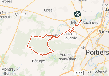
Trail Mountain bike of 32 km to be discovered at New Aquitaine, Vienne, Migné-Auxances. This trail is proposed by leroj73.
Positioning
Country:
France
Region :
New Aquitaine
Department/Province :
Vienne
Municipality :
Migné-Auxances
Location:
Unknown
Start:(Dec)
Start:(UTM)
293526 ; 5167487 (31T) N.
Comments