


Odeigne (boucle 1)

xtislair
User
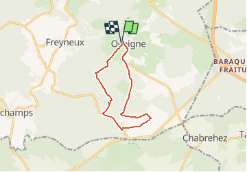

Length
9.9 km

Max alt
610 m

Uphill gradient
216 m
Km-Effort
12.8 km

Min alt
486 m

Downhill gradient
217 m
Boucle
Yes
Creation date :
2021-04-03 07:03:52.408
Updated on :
2021-04-03 12:43:30.25
2h54
Difficulty : Difficult

FREE GPS app for hiking
 SityTrail
IGN / Geographical institutes
SityTrail Plus
The world is yours!
About
Trail Walking of 9.9 km to be discovered at Wallonia, Luxembourg, Manhay. This trail is proposed by xtislair.
Positioning
Country:
Belgium
Region :
Wallonia
Department/Province :
Luxembourg
Municipality :
Manhay
Location:
Odeigne
Start:(Dec)
Start:(UTM)
690990 ; 5570571 (31U) N.
Comments