


Arboussols - Marcevol

robertperello
User
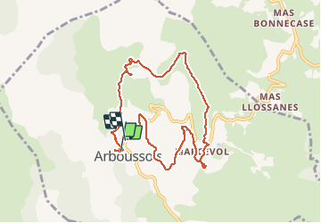

Length
9.6 km

Max alt
660 m

Uphill gradient
166 m
Km-Effort
11.9 km

Min alt
509 m

Downhill gradient
174 m
Boucle
Yes
Creation date :
2021-04-04 09:25:20.0
Updated on :
2021-04-04 14:14:14.603
2h57
Difficulty : Very easy

FREE GPS app for hiking
 SityTrail
IGN / Geographical institutes
SityTrail Plus
The world is yours!
About
Trail Walking of 9.6 km to be discovered at Occitania, Pyrénées-Orientales, Arboussols. This trail is proposed by robertperello.
Description
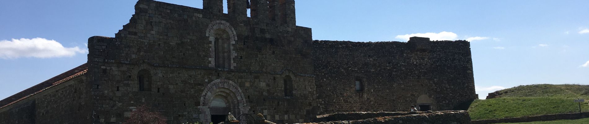
Par Sté Eulalie
Photos


Positioning
Country:
France
Region :
Occitania
Department/Province :
Pyrénées-Orientales
Municipality :
Arboussols
Location:
Unknown
Start:(Dec)
Start:(UTM)
457754 ; 4723647 (31T) N.
Comments