


Saou

raygautier
User

Length
17.5 km

Max alt
1054 m

Uphill gradient
784 m
Km-Effort
28 km

Min alt
393 m

Downhill gradient
803 m
Boucle
No
Creation date :
2021-04-04 07:04:32.0
Updated on :
2021-04-04 14:31:56.145
7h06
Difficulty : Very difficult

FREE GPS app for hiking
 SityTrail
IGN / Geographical institutes
SityTrail Plus
The world is yours!
About
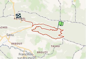
Trail Walking of 17.5 km to be discovered at Auvergne-Rhône-Alpes, Drôme, Saou. This trail is proposed by raygautier.
Positioning
Country:
France
Region :
Auvergne-Rhône-Alpes
Department/Province :
Drôme
Municipality :
Saou
Location:
Unknown
Start:(Dec)
Start:(UTM)
669007 ; 4946491 (31T) N.
Comments