


les ollieres

COMAN
User
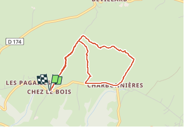

Length
4.2 km

Max alt
802 m

Uphill gradient
67 m
Km-Effort
5.1 km

Min alt
766 m

Downhill gradient
67 m
Boucle
Yes
Creation date :
2021-04-09 07:13:54.029
Updated on :
2022-12-11 19:27:49.97
1h45
Difficulty : Medium

FREE GPS app for hiking
 SityTrail
IGN / Geographical institutes
SityTrail Plus
The world is yours!
About
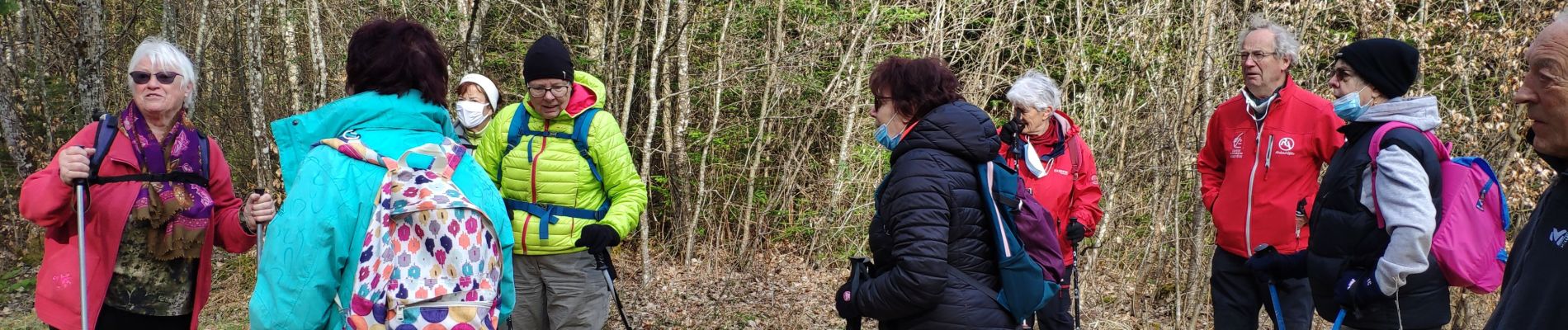
Trail Walking of 4.2 km to be discovered at Auvergne-Rhône-Alpes, Upper Savoy, Fillière. This trail is proposed by COMAN.
Photos


Positioning
Country:
France
Region :
Auvergne-Rhône-Alpes
Department/Province :
Upper Savoy
Municipality :
Fillière
Location:
Les Ollières
Start:(Dec)
Start:(UTM)
282698 ; 5095629 (32T) N.
Comments