


Sma4

magbjo
User
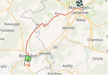

Length
19.7 km

Max alt
298 m

Uphill gradient
289 m
Km-Effort
24 km

Min alt
169 m

Downhill gradient
323 m
Boucle
No
Creation date :
2021-04-11 07:32:16.0
Updated on :
2021-04-11 12:02:47.739
4h29
Difficulty : Very difficult

FREE GPS app for hiking
 SityTrail
IGN / Geographical institutes
SityTrail Plus
The world is yours!
About
Trail Walking of 19.7 km to be discovered at Wallonia, Namur, Rochefort. This trail is proposed by magbjo.
Positioning
Country:
Belgium
Region :
Wallonia
Department/Province :
Namur
Municipality :
Rochefort
Location:
Rochefort
Start:(Dec)
Start:(UTM)
658219 ; 5557124 (31U) N.
Comments