


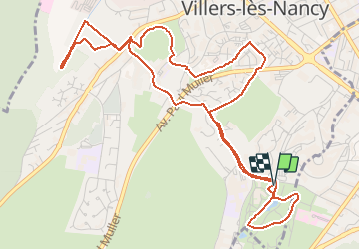
Villers _ du jardin botanique à la source de l'Asnée

ZAMBAUX
User

Length
6.4 km

Max alt
298 m

Uphill gradient
151 m
Km-Effort
8.4 km

Min alt
234 m

Downhill gradient
154 m
Boucle
Yes
Creation date :
2021-04-11 17:21:43.203
Updated on :
2021-04-13 06:51:12.322
1h54
Difficulty : Medium

FREE GPS app for hiking
 SityTrail
IGN / Geographical institutes
SityTrail Plus
The world is yours!
About
Trail Walking of 6.4 km to be discovered at Grand Est, Meurthe-et-Moselle, Villers-lès-Nancy. This trail is proposed by ZAMBAUX.
Positioning
Country:
France
Region :
Grand Est
Department/Province :
Meurthe-et-Moselle
Municipality :
Villers-lès-Nancy
Location:
Unknown
Start:(Dec)
Start:(UTM)
290535 ; 5393902 (32U) N.
Comments