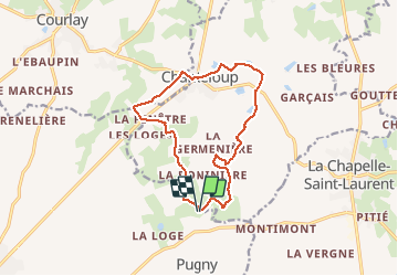
29 km | 34 km-effort
rando du 12-04-2021
dudu79
User
Length
13.2 km
Max alt
227 m
Uphill gradient
132 m
Km-Effort
15 km
Min alt
177 m
Downhill gradient
133 m
Boucle
Yes
Creation date :
2021-04-12 12:02:52.386
Updated on :
2021-04-12 15:12:30.774
2h41
Difficulty : Difficult
FREE GPS app for hiking
About
Trail Walking of 13.2 km to be discovered at New Aquitaine, Deux-Sèvres, Moncoutant-sur-Sèvre. This trail is proposed by dudu79.
Description
départ et retour chez Gigi
Positioning
Country:
France
Region :
New Aquitaine
Department/Province :
Deux-Sèvres
Municipality :
Moncoutant-sur-Sèvre
Location:
Pugny
Start:(Dec)
Start:(UTM)
689209 ; 5179083 (30T) N.
Comments
Trails nearby
2013-10-20 - La Chapelle St Laurent
Mountain bike
Easy
La Chapelle-Saint-Laurent,
New Aquitaine,
Deux-Sèvres,
France
2h 15min
Yes
GR364-Jour n°1
Walking
Very difficult
Moncoutant-sur-Sèvre,
New Aquitaine,
Deux-Sèvres,
France
27 km | 32 km-effort
7h 21min
No
Courlay terves Mct
Walking
Easy
Moncoutant-sur-Sèvre,
New Aquitaine,
Deux-Sèvres,
France
23 km | 26 km-effort
5h 27min
Yes
randonnée du 22-04-2021
Walking
Medium
Moncoutant-sur-Sèvre,
New Aquitaine,
Deux-Sèvres,
France
7.3 km | 8.1 km-effort
1h 42min
Yes
marche du 08 Mai 24
Walking
Easy
Moncoutant-sur-Sèvre,
New Aquitaine,
Deux-Sèvres,
France
15.6 km | 17.8 km-effort
4h 0min
Yes
Rando du 27 Mars 2023
Walking
Very difficult
Moncoutant-sur-Sèvre,
New Aquitaine,
Deux-Sèvres,
France
18.2 km | 20 km-effort
4h 35min
Yes
A-R maison 12,540km
Walking
Difficult
Moncoutant-sur-Sèvre,
New Aquitaine,
Deux-Sèvres,
France
12.5 km | 14.4 km-effort
3h 16min
Yes
Départ Chanteloup +-14km
Walking
Difficult
Chanteloup,
New Aquitaine,
Deux-Sèvres,
France
14 km | 15.9 km-effort
3h 36min
Yes
rando avec JM & Cath du 20-04-2022
Walking
Very difficult
Moncoutant-sur-Sèvre,
New Aquitaine,
Deux-Sèvres,
France
22 km | 25 km-effort
5h 35min
Yes
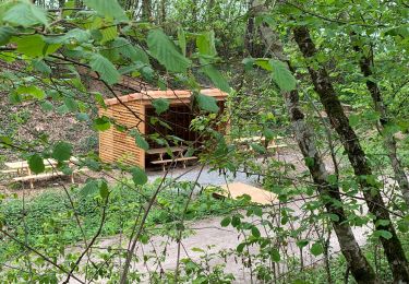
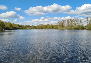
Très belle rando avec très peu de route