


Champcevinel

philou68
User
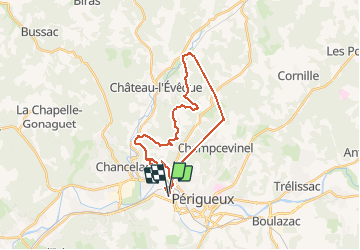

Length
27 km

Max alt
202 m

Uphill gradient
682 m
Km-Effort
36 km

Min alt
81 m

Downhill gradient
679 m
Boucle
Yes
Creation date :
2021-04-14 06:52:08.429
Updated on :
2021-04-14 15:17:23.866
8h00
Difficulty : Easy

FREE GPS app for hiking
 SityTrail
IGN / Geographical institutes
SityTrail Plus
The world is yours!
About
Trail Walking of 27 km to be discovered at New Aquitaine, Dordogne, Coulounieix-Chamiers. This trail is proposed by philou68.
Positioning
Country:
France
Region :
New Aquitaine
Department/Province :
Dordogne
Municipality :
Coulounieix-Chamiers
Location:
Unknown
Start:(Dec)
Start:(UTM)
318953 ; 5006988 (31T) N.
Comments