


A proximité de l'étang de Lachamp

Gegetop
User

Length
9.3 km

Max alt
888 m

Uphill gradient
272 m
Km-Effort
12.9 km

Min alt
743 m

Downhill gradient
276 m
Boucle
Yes
Creation date :
2018-01-18 00:00:00.0
Updated on :
2018-01-18 00:00:00.0
2h30
Difficulty : Easy

FREE GPS app for hiking
 SityTrail
IGN / Geographical institutes
SityTrail Plus
The world is yours!
About
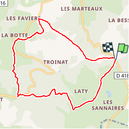
Trail Walking of 9.3 km to be discovered at Auvergne-Rhône-Alpes, Puy-de-Dôme, Manzat. This trail is proposed by Gegetop.
Description
Balade facile et très agréable alternant des chemins ombragés et des chemins dégagés permettant de profiter du soleil et de la nature.
Positioning
Country:
France
Region :
Auvergne-Rhône-Alpes
Department/Province :
Puy-de-Dôme
Municipality :
Manzat
Location:
Unknown
Start:(Dec)
Start:(UTM)
496033 ; 5086841 (31T) N.
Comments