


Rochepradiere-Le Colombier-Chazeron

Gegetop
User
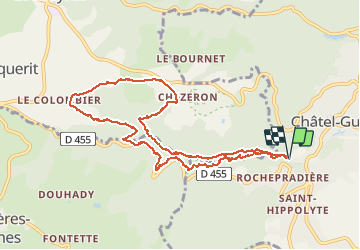

Length
9.9 km

Max alt
691 m

Uphill gradient
253 m
Km-Effort
13.3 km

Min alt
449 m

Downhill gradient
253 m
Boucle
Yes
Creation date :
2021-04-17 11:55:11.21
Updated on :
2021-04-17 14:21:19.436
2h35
Difficulty : Difficult
2h19
Difficulty : Medium

FREE GPS app for hiking
 SityTrail
IGN / Geographical institutes
SityTrail Plus
The world is yours!
About
Trail Walking of 9.9 km to be discovered at Auvergne-Rhône-Alpes, Puy-de-Dôme, Châtel-Guyon. This trail is proposed by Gegetop.
Description
Dénivelé important mais très belle balade.
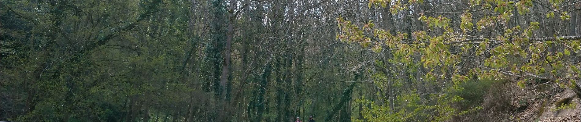
Photos

Positioning
Country:
France
Region :
Auvergne-Rhône-Alpes
Department/Province :
Puy-de-Dôme
Municipality :
Châtel-Guyon
Location:
Unknown
Start:(Dec)
Start:(UTM)
504084 ; 5084711 (31T) N.
Comments