


2021-04-18_08h49m41_8372848

dehemjacques
User
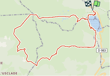

Length
13.6 km

Max alt
1479 m

Uphill gradient
489 m
Km-Effort
20 km

Min alt
1246 m

Downhill gradient
489 m
Boucle
Yes
Creation date :
2021-04-18 06:49:41.324
Updated on :
2021-04-18 06:49:45.753

FREE GPS app for hiking
 SityTrail
IGN / Geographical institutes
SityTrail Plus
The world is yours!
About
Trail of 13.6 km to be discovered at Auvergne-Rhône-Alpes, Puy-de-Dôme, Perpezat. This trail is proposed by dehemjacques.
Positioning
Country:
France
Region :
Auvergne-Rhône-Alpes
Department/Province :
Puy-de-Dôme
Municipality :
Perpezat
Location:
Unknown
Start:(Dec)
Start:(UTM)
486011 ; 5051895 (31T) N.
Comments