


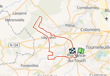
Boucle Bouconne par Léguevin

Alouest31
User

Length
31 km

Max alt
245 m

Uphill gradient
285 m
Km-Effort
35 km

Min alt
162 m

Downhill gradient
286 m
Boucle
Yes
Creation date :
2021-04-18 09:44:43.421
Updated on :
2021-04-18 09:46:03.813
2h30
Difficulty : Easy

FREE GPS app for hiking
 SityTrail
IGN / Geographical institutes
SityTrail Plus
The world is yours!
About
Trail Cycle of 31 km to be discovered at Occitania, Haute-Garonne, Plaisance-du-Touch. This trail is proposed by Alouest31.
Positioning
Country:
France
Region :
Occitania
Department/Province :
Haute-Garonne
Municipality :
Plaisance-du-Touch
Location:
Unknown
Start:(Dec)
Start:(UTM)
362543 ; 4825083 (31T) N.
Comments