


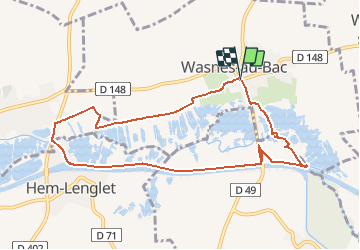
Boucle Wasnes au Bac Hem Lenglet

BrassensJC
User

Length
8.7 km

Max alt
44 m

Uphill gradient
43 m
Km-Effort
9.3 km

Min alt
32 m

Downhill gradient
44 m
Boucle
Yes
Creation date :
2021-04-18 09:59:10.825
Updated on :
2021-04-18 09:59:49.545
2h06
Difficulty : Medium

FREE GPS app for hiking
 SityTrail
IGN / Geographical institutes
SityTrail Plus
The world is yours!
About
Trail Walking of 8.7 km to be discovered at Hauts-de-France, Nord, Wasnes-au-Bac. This trail is proposed by BrassensJC.
Positioning
Country:
France
Region :
Hauts-de-France
Department/Province :
Nord
Municipality :
Wasnes-au-Bac
Location:
Unknown
Start:(Dec)
Start:(UTM)
518333 ; 5568644 (31U) N.
Comments