Trail Walking Villegailhenc - Villegailhenc Conques Aragon - Photo

Villegailhenc Conques Aragon

 Ada11
Ada11

User GUIDE

© OpenStreetMap contributors
Length
Length
23 km
Max alt
Max alt
284 m
Uphill gradient
Uphill gradient
421 m
Km-Effort
Km-Effort  
29 km
Min alt
Min alt
126 m
Downhill gradient
Downhill gradient
420 m
Boucle
Boucle
Yes
Creation date :
2021-04-18 06:45:14.986
Updated on :
2021-04-19 11:17:36.174

(0 Reviews)

Walking
Walking
5h45
Difficulty : Medium

Scan this QR Code to open this trail in the SityTrail application

FREE GPS app for hiking

Logo SityTrail SityTrail

IGN / Geographical institutes

Download SityTrail from the App Store Download SityTrail from Google Play

Logo SityTrail SityTrail World

The world is yours!

Download SityTrail from the App Store Download SityTrail from Google Play Download SityTrail on Huawei AppGallery

About

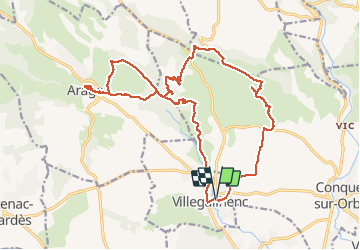
Trail Walking of 23 km to be discovered at Occitania, Aude, Villegailhenc. This trail is proposed by Ada11.

Description

Un morceau de route en trop car chemin dans la garrigue raté, à corriger.
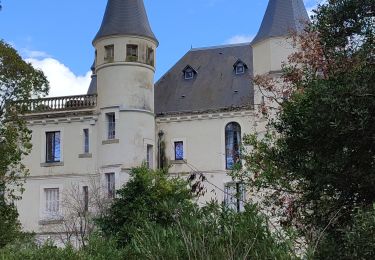
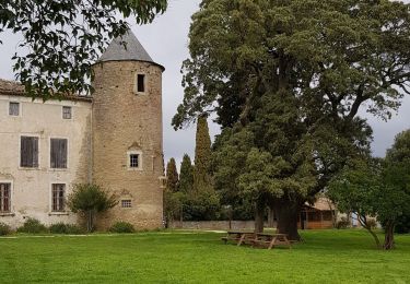
Passage dans une propriété privée : Prieuré du font Juvénal. Le portail était ouvert, nous avons sonné pour demander la permission de traverser, sans réponse. Mais les gens du coin rencontrés par la suite sur le chemin disent que nous avons eu de la chance de ne pas avoir rencontré le propriétaire, pas ouvert aux randonneurs et procédurier. À éviter donc.
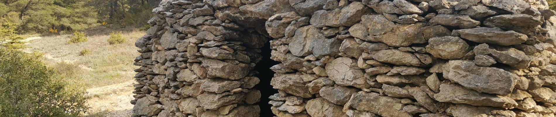
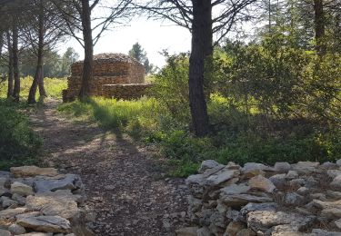
Beaucoup plus de capitelles à rencontrer dans le coin, à Conques au début de la rando ou à Aragon.

Elevation profile

Photos

Positioning

Country:
France
Region :
Occitania
Department/Province :
Aude
Municipality :
Villegailhenc
Location:
Unknown
Start:(UTM)
447868 ; 4790840 (31T) N.

Trails nearby

Trail Walking Aragon - GARILLE - FONT DE L'ORME - GARILLE - Photo
Walking
Combaut11

Walking

Medium
(1)
Aragon, Occitania, Aude, France
6 km | 7.4 km-effort
1h 41min
Yes
Trail On foot Conques-sur-Orbiel - Conques-Les Capitelles - Photo
On foot
dufland

On foot

Easy
(2)
Conques-sur-Orbiel, Occitania, Aude, France
6.4 km | 7.7 km-effort
2h 30min
Yes
Trail Walking Conques-sur-Orbiel - village celte - Photo
Walking
oliviercaty

Walking

Easy
(1)
Conques-sur-Orbiel, Occitania, Aude, France
3.9 km | 4.8 km-effort
1h 48min
Yes
Trail Walking Pennautier - circuit des ponts de pierre à Pennautier - Photo
Walking
bernardbelmas

Walking

Easy
Pennautier, Occitania, Aude, France
8.6 km | 10 km-effort
2h 34min
Yes
Trail Walking Conques-sur-Orbiel - les capitales à Conques - Photo
Walking
bernardbelmas

Walking

Easy
Conques-sur-Orbiel, Occitania, Aude, France
4.3 km | 5.2 km-effort
1h 36min
Yes
Trail Walking Conques-sur-Orbiel - Conques-Les Capitelles 5.6 - Photo
Walking
dufland

Walking

Medium
(1)
Conques-sur-Orbiel, Occitania, Aude, France
5.5 km | 6.6 km-effort
1h 31min
Yes
Trail Walking Villalier - boucle Villalier La Mee les cabanes dans les bois - Photo
Walking
bernardbelmas

Walking

Very easy
Villalier, Occitania, Aude, France
6.8 km | 8.1 km-effort
1h 58min
Yes
Trail Walking Aragon - Garille - Aragon - Photo
Walking
mikaou.t

Walking

Easy
(1)
Aragon, Occitania, Aude, France
9.3 km | 11.6 km-effort
2h 30min
Yes
Trail Walking Aragon - Aragon - Photo
Walking
JohnTompa

Walking

Very easy
(1)
Aragon, Occitania, Aude, France
9.3 km | 11.3 km-effort
Unknown
Yes


Close
My subscriptions