Trail Walking Gergueil - balcon de l'Ouche - Photo
 mpstoop
mpstoop

User

© OpenStreetMap contributors
Length
Length
38 km
Max alt
Max alt
622 m
Uphill gradient
Uphill gradient
918 m
Km-Effort
Km-Effort  
50 km
Min alt
Min alt
322 m
Downhill gradient
Downhill gradient
1000 m
Boucle
Boucle
No
Creation date :
2021-04-19 05:15:40.045
Updated on :
2021-04-20 17:53:50.77

(0 Reviews)

Walking
Walking
9h28
Difficulty : Very difficult

Scan this QR Code to open this trail in the SityTrail application

FREE GPS app for hiking

Logo SityTrail SityTrail

IGN / Geographical institutes

Download SityTrail from the App Store Download SityTrail from Google Play

Logo SityTrail SityTrail Plus

The world is yours!

Download SityTrail from the App Store Download SityTrail from Google Play Download SityTrail on Huawei AppGallery

About

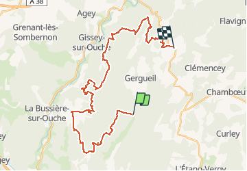
Trail Walking of 38 km to be discovered at Bourgogne-Franche-Comté, Côte-d'Or, Gergueil. This trail is proposed by mpstoop.

Description

Beau chemins forestiers giboyeux,accessibles en VTT ;fortes dénivelées et combes profondes,rochers, arbres remarquables ,falaises avec vues étendues, grotte, fermes et puits recouverts par la forêt, camps militaire Allemand rasé et regagné par la végetation : c'est une longue journée d'aventure sportive , énigme et contemplation qui marquera durablement vos souvenirs .

Elevation profile

Photos

Points of interest

Point of interest Saint-Jean-de-Bœuf - casernement Allemand - Photo
mpstoop
SAINT-JEAN-DE-BŒUF 
Point of interest Arcey - belvédère - Photo
mpstoop
Point of interest Saint-Victor-sur-Ouche - belvédère étendu - Photo
mpstoop
SAINT-VICTOR-SUR-OUCHE 
Point of interest Ternant - grotte de Roche Chèvre - Photo
mpstoop

Positioning

Country:
France
Region :
Bourgogne-Franche-Comté
Department/Province :
Côte-d'Or
Municipality :
Gergueil
Location:
Unknown
Start:(UTM)
637090 ; 5230632 (31T) N.


Close
My subscriptions