Trail Walking Saint-Blaise - St Blaise - Mont Inarte - Mont Cima  - Photo

St Blaise - Mont Inarte - Mont Cima

© OpenStreetMap contributors
Length
Length
10.6 km
Max alt
Max alt
867 m
Uphill gradient
Uphill gradient
636 m
Km-Effort
Km-Effort  
19 km
Min alt
Min alt
318 m
Downhill gradient
Downhill gradient
635 m
Boucle
Boucle
Yes
Creation date :
2021-04-22 07:21:07.504
Updated on :
2021-04-28 08:40:44.797

(0 Reviews)

Walking
Walking
5h00
Difficulty : Difficult

Scan this QR Code to open this trail in the SityTrail application

FREE GPS app for hiking

Logo SityTrail SityTrail

IGN / Geographical institutes

Download SityTrail from the App Store Download SityTrail from Google Play

Logo SityTrail SityTrail World

The world is yours!

Download SityTrail from the App Store Download SityTrail from Google Play Download SityTrail on Huawei AppGallery

About

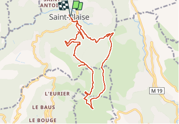
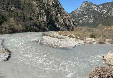
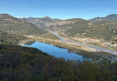
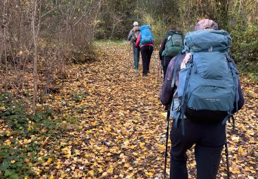
Trail Walking of 10.6 km to be discovered at Provence-Alpes-Côte d'Azur, Maritime Alps, Saint-Blaise. This trail is proposed by clarambre.

Description

Boucle de 11 km avec 635 m de dénivelé

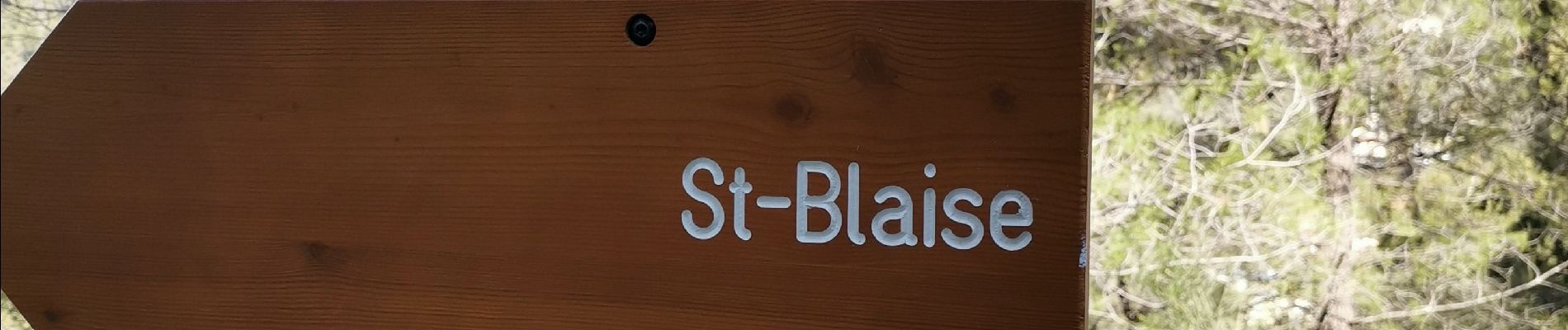
Passage insolite CAMPO PLAN

Elevation profile

Photos

Positioning

Country:
France
Region :
Provence-Alpes-Côte d'Azur
Department/Province :
Maritime Alps
Municipality :
Saint-Blaise
Location:
Unknown
Start:(UTM)
358455 ; 4853542 (32T) N.

Trails nearby

Trail Walking Aspremont - Aspremont tour du Mont Chauve, montée au fort. - Photo
Walking
jll7513

Walking

Difficult
(1)
Aspremont, Provence-Alpes-Côte d'Azur, Maritime Alps, France
7.5 km | 12 km-effort
2h 44min
Yes
Trail On foot Coaraze - Rocca Sparvièra - Photo
On foot
PRO

On foot

Easy
Coaraze, Provence-Alpes-Côte d'Azur, Maritime Alps, France
10.5 km | 17.6 km-effort
3h 59min
Yes
Trail On foot Carros - Les Balcons de Carros - Photo
On foot
PRO

On foot

Easy
Carros, Provence-Alpes-Côte d'Azur, Maritime Alps, France
4.9 km | 9.1 km-effort
2h 4min
Yes
Trail Walking Coaraze - Rocca Spavierra - Photo
Walking
franquen

Walking

Medium
(1)
Coaraze, Provence-Alpes-Côte d'Azur, Maritime Alps, France
11.6 km | 19.6 km-effort
4h 6min
Yes
Trail Walking Levens - Hike 2017 jour 1 - Photo
Walking
albert318

Walking

Very difficult
(1)
Levens, Provence-Alpes-Côte d'Azur, Maritime Alps, France
14.7 km | 29 km-effort
6h 27min
No
Trail Running Aspremont - Tour des Monts d'Aspremont 2007 - Photo
Running
tracegps

Running

Very difficult
(2)
Aspremont, Provence-Alpes-Côte d'Azur, Maritime Alps, France
21 km | 33 km-effort
3h 0min
Yes
Trail Walking Bonson - Plan du Var-Tourrette du Château  - Photo
Walking
ETMU5496

Walking

Difficult
Bonson, Provence-Alpes-Côte d'Azur, Maritime Alps, France
19.1 km | 35 km-effort
7h 50min
Yes
Trail Walking Le Broc - Le Broc (lac) ; le mouton d'Anou - Photo
Walking
ETMU5496

Walking

Medium
Le Broc, Provence-Alpes-Côte d'Azur, Maritime Alps, France
17 km | 30 km-effort
6h 51min
Yes
Trail Walking Le Broc - Mouton d'Annou depuis lac du broc réel - Photo
Walking
jouans

Walking

Very difficult
Le Broc, Provence-Alpes-Côte d'Azur, Maritime Alps, France
17 km | 30 km-effort
6h 52min
Yes


Close
My subscriptions