


Col du rôtisson

raygautier
User

Length
9.6 km

Max alt
523 m

Uphill gradient
198 m
Km-Effort
13.3 km

Min alt
94 m

Downhill gradient
522 m
Boucle
No
Creation date :
2021-04-22 14:47:28.0
Updated on :
2021-04-22 15:47:16.503
17m
Difficulty : Difficult

FREE GPS app for hiking
 SityTrail
IGN / Geographical institutes
SityTrail Plus
The world is yours!
About
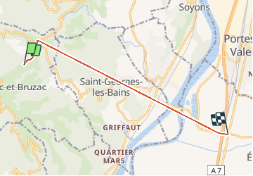
Trail Walking of 9.6 km to be discovered at Auvergne-Rhône-Alpes, Ardèche. This trail is proposed by raygautier.
Positioning
Country:
France
Region :
Auvergne-Rhône-Alpes
Department/Province :
Ardèche
Municipality :
GILHAC-ET-BRUZAC
Location:
Unknown
Start:(Dec)
Start:(UTM)
639612 ; 4969842 (31T) N.
Comments