Trail Walking Charbonnières-les-Varennes - Le Puy de Paugnat  - Photo
 Gegetop
Gegetop

User

© OpenStreetMap contributors
Length
Length
10.7 km
Max alt
Max alt
900 m
Uphill gradient
Uphill gradient
241 m
Km-Effort
Km-Effort  
13.9 km
Min alt
Min alt
773 m
Downhill gradient
Downhill gradient
238 m
Boucle
Boucle
Yes
Creation date :
2021-04-23 11:53:33.097
Updated on :
2021-04-24 15:37:10.042

(0 Reviews)

Walking
Walking
2h40
Difficulty : Medium
Nordic walking
Nordic walking
2h20
Difficulty : Medium

Scan this QR Code to open this trail in the SityTrail application

FREE GPS app for hiking

Logo SityTrail SityTrail

IGN / Geographical institutes

Download SityTrail from the App Store Download SityTrail from Google Play

Logo SityTrail SityTrail World

The world is yours!

Download SityTrail from the App Store Download SityTrail from Google Play Download SityTrail on Huawei AppGallery

About

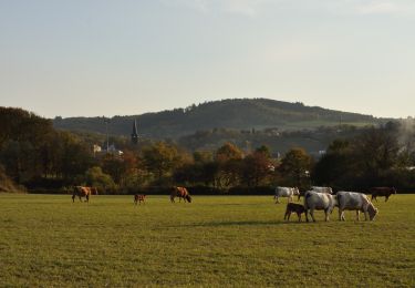
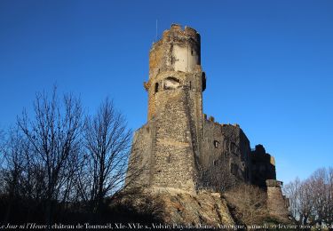
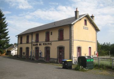
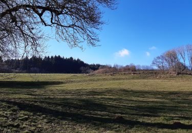
Trail Walking of 10.7 km to be discovered at Auvergne-Rhône-Alpes, Puy-de-Dôme, Charbonnières-les-Varennes. This trail is proposed by Gegetop.

Description

Le point de départ est différent mais la boucle est identique.
La montée au sommet du Puy vous offrira un magnifique panorama.

Elevation profile

Photos

Positioning

Country:
France
Region :
Auvergne-Rhône-Alpes
Department/Province :
Puy-de-Dôme
Municipality :
Charbonnières-les-Varennes
Location:
Unknown
Start:(UTM)
497378 ; 5081729 (31T) N.

Trails nearby

Trail Mountain bike Volvic - Tour du Puy de Dôme en VTT - Photo
Mountain bike
tracegps

Mountain bike

Very difficult
(1)
Volvic, Auvergne-Rhône-Alpes, Puy-de-Dôme, France
62 km | 85 km-effort
5h 30min
Yes
Trail Walking Volvic - Les sources de Volvic - Photo
Walking
tracegps

Walking

Medium
(2)
Volvic, Auvergne-Rhône-Alpes, Puy-de-Dôme, France
10.9 km | 14.3 km-effort
3h 0min
Yes
Trail Walking Volvic - Egaules (près de Luzet) - Photo
Walking
tracegps

Walking

Difficult
(1)
Volvic, Auvergne-Rhône-Alpes, Puy-de-Dôme, France
8.8 km | 10.8 km-effort
2h 45min
Yes
Trail On foot Manzat - Aux Sources de la Morge - Photo
On foot
PRO

On foot

Medium
Manzat, Auvergne-Rhône-Alpes, Puy-de-Dôme, France
16.3 km | 23 km-effort
5h 8min
Yes
Trail On foot Volvic - Les Sources de Volvic - Photo
On foot
PRO

On foot

Easy
Volvic, Auvergne-Rhône-Alpes, Puy-de-Dôme, France
10.5 km | 13.9 km-effort
3h 10min
Yes
Trail On foot Volvic - Egaules - Photo
On foot
PRO

On foot

Easy
Volvic, Auvergne-Rhône-Alpes, Puy-de-Dôme, France
8 km | 10 km-effort
2h 16min
Yes
Trail Walking Volvic - 2021-08-19 11-42-50-MNT - Photo
Walking
GUIDE
jagarnier

Walking

Medium
Volvic, Auvergne-Rhône-Alpes, Puy-de-Dôme, France
8.9 km | 12.1 km-effort
2h 30min
Yes
Trail On foot Manzat - La Roche de Sauterre - Photo
On foot
PRO

On foot

Easy
Manzat, Auvergne-Rhône-Alpes, Puy-de-Dôme, France
4.2 km | 5.8 km-effort
1h 18min
Yes
Trail Walking Saint-Ours - Puy de Jume puy de Coquille depuis parking  avant Beauregard - Photo
Walking
Patricew

Walking

Medium
Saint-Ours, Auvergne-Rhône-Alpes, Puy-de-Dôme, France
10.9 km | 14.9 km-effort
2h 43min
Yes


Close
My subscriptions