


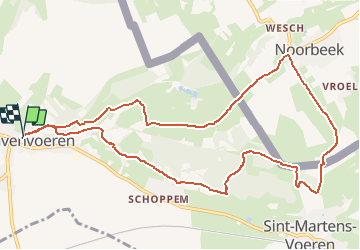
s'Gravenvoeren 10,8km
© OpenStreetMap contributors


--
Difficulty : Unknown


Length
10.8 km
Max alt
209 m
Uphill gradient
244 m
Km-Effort
14.1 km
Min alt
87 m
Downhill gradient
243 m
Boucle
Yes
Creation date :
2014-12-10 00:00:00.0
Updated on :
2014-12-10 00:00:00.0
--
Difficulty : Unknown
FREE GPS app for hiking
 SityTrail
IGN / Geographical institutes
SityTrail Plus
The world is yours!
About
Trail Walking of 10.8 km to be discovered at Flanders, Limburg, Voeren. This trail is proposed by wandelgidszuidlimburg.
Description
More information on : http://www.wandelgidszuidlimburg.com


Positioning
Country:
Belgium
Region :
Flanders
Department/Province :
Limburg
Municipality :
Voeren
Location:
's-Gravenvoeren
Start:(Dec)
Start:(UTM)
694849 ; 5626664 (31U) N.
Comments
N° 51. Une balade campagnarde et transfrontalière cheminant entre la Noor et la Voer dans la réserve naturelle Altenbroek.