


Haut Montet

domi06
User


6h00
Difficulty : Medium

FREE GPS app for hiking
 SityTrail
IGN / Geographical institutes
SityTrail Plus
The world is yours!
About
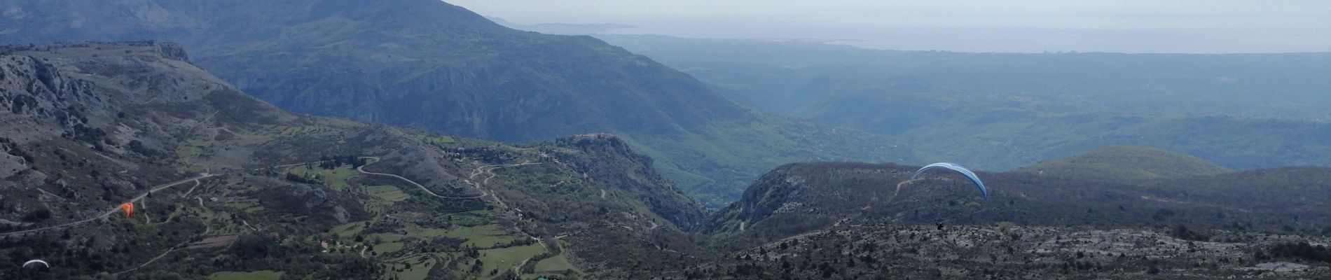
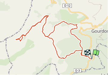
Trail Walking of 15 km to be discovered at Provence-Alpes-Côte d'Azur, Maritime Alps, Gourdon. This trail is proposed by domi06.
Description
Parking entre la Sarrée et Gourdon. Départ de la balise 17 suivre une piste dans le bois de Gourdon puis un sentier qui nous mène à la source du Naouq. De ce point direction l'Embarnier puis belle montée vers l'aire d'envol des deltaplanes. Longer la crête pour admirer le paysage et atteindre le Haut Montet 1335m. Revenir à l'aire d'envol, puis à l'Embarnier. Bifurquer à environ 11,6km, gros cairn vers le mas de Cauvin pour découvrir quelques belles bories avant d'atteindre le parking.
Cotation E3/T2/R2
Photos


Positioning
Comments