


Chemin de l'enfer Ligny Vignelle

lemuid
User
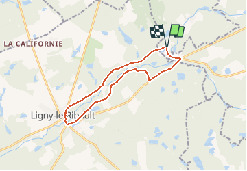

Length
12.2 km

Max alt
119 m

Uphill gradient
93 m
Km-Effort
13.4 km

Min alt
89 m

Downhill gradient
94 m
Boucle
Yes
Creation date :
2021-02-24 16:04:54.137
Updated on :
2021-04-25 17:20:33.99
2h10
Difficulty : Very easy

FREE GPS app for hiking
 SityTrail
IGN / Geographical institutes
SityTrail Plus
The world is yours!
About
Trail Walking of 12.2 km to be discovered at Centre-Loire Valley, Loiret, Jouy-le-Potier. This trail is proposed by lemuid.
Positioning
Country:
France
Region :
Centre-Loire Valley
Department/Province :
Loiret
Municipality :
Jouy-le-Potier
Location:
Unknown
Start:(Dec)
Start:(UTM)
412562 ; 5284524 (31T) N.
Comments