


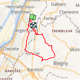
Saint-Remy 11,5km
© OpenStreetMap contributors


--
Difficulty : Unknown


Length
12.2 km
Max alt
182 m
Uphill gradient
297 m
Km-Effort
16 km
Min alt
78 m
Downhill gradient
242 m
Boucle
No
Creation date :
2014-12-10 00:00:00.0
Updated on :
2014-12-10 00:00:00.0
--
Difficulty : Unknown
FREE GPS app for hiking
 SityTrail
IGN / Geographical institutes
SityTrail Plus
The world is yours!
About
Trail Walking of 12.2 km to be discovered at Wallonia, Liège, Visé. This trail is proposed by wandelgidszuidlimburg.
Description
More information on : http://www.wandelgidszuidlimburg.com


Positioning
Country:
Belgium
Region :
Wallonia
Department/Province :
Liège
Municipality :
Visé
Location:
Argenteau
Start:(Dec)
Start:(UTM)
689937 ; 5619928 (31U) N.
Comments
42.328