


cavalière 2021 04 28

Patrick Lemaire
User
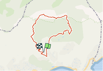

Length
9.3 km

Max alt
455 m

Uphill gradient
472 m
Km-Effort
15.6 km

Min alt
17 m

Downhill gradient
477 m
Boucle
Yes
Creation date :
2021-04-28 08:05:03.953
Updated on :
2021-04-28 14:41:02.242
3h24
Difficulty : Difficult

FREE GPS app for hiking
 SityTrail
IGN / Geographical institutes
SityTrail Plus
The world is yours!
About
Trail Walking of 9.3 km to be discovered at Provence-Alpes-Côte d'Azur, Var, Le Lavandou. This trail is proposed by Patrick Lemaire.
Description
rando jaune
Positioning
Country:
France
Region :
Provence-Alpes-Côte d'Azur
Department/Province :
Var
Municipality :
Le Lavandou
Location:
Unknown
Start:(Dec)
Start:(UTM)
290108 ; 4781644 (32T) N.
Comments