


Ludres 10 320m +146m

DanielROLLET
User
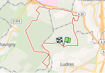

Length
10.3 km

Max alt
423 m

Uphill gradient
146 m
Km-Effort
12.3 km

Min alt
373 m

Downhill gradient
145 m
Boucle
Yes
Creation date :
2021-05-01 07:26:51.761
Updated on :
2021-05-01 14:25:15.72
1h55
Difficulty : Very easy

FREE GPS app for hiking
 SityTrail
IGN / Geographical institutes
SityTrail Plus
The world is yours!
About
Trail Nordic walking of 10.3 km to be discovered at Grand Est, Meurthe-et-Moselle, Ludres. This trail is proposed by DanielROLLET.
Description
2021 05 01 Marche nordique avec Marie - 09h30 à 11h25
Temps frais et couvert mais calme
Muguet sorti mais pas en boutons
Positioning
Country:
France
Region :
Grand Est
Department/Province :
Meurthe-et-Moselle
Municipality :
Ludres
Location:
Unknown
Start:(Dec)
Start:(UTM)
290665 ; 5390071 (32U) N.
Comments