


Le SALEVE

Jean-Paulchoux
User
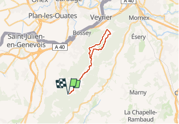

Length
21 km

Max alt
1378 m

Uphill gradient
791 m
Km-Effort
32 km

Min alt
1083 m

Downhill gradient
791 m
Boucle
Yes
Creation date :
2021-05-02 07:02:18.539
Updated on :
2021-05-03 18:57:01.087
6h22
Difficulty : Difficult

FREE GPS app for hiking
 SityTrail
IGN / Geographical institutes
SityTrail Plus
The world is yours!
About
Trail Walking of 21 km to be discovered at Auvergne-Rhône-Alpes, Upper Savoy, Beaumont. This trail is proposed by Jean-Paulchoux.
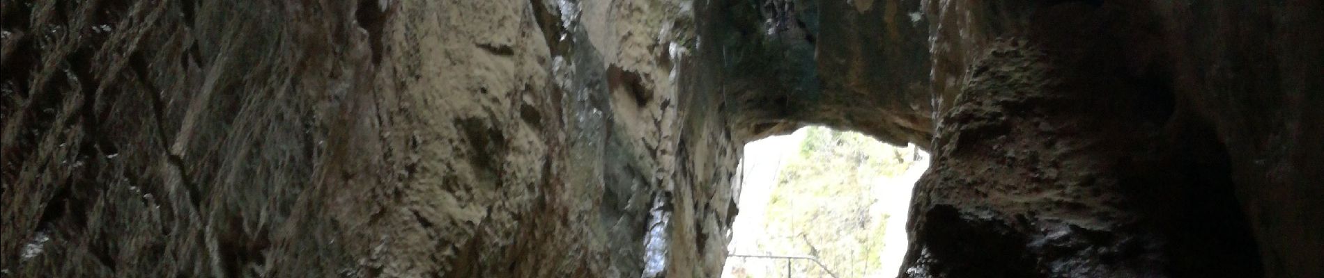
Photos


Positioning
Country:
France
Region :
Auvergne-Rhône-Alpes
Department/Province :
Upper Savoy
Municipality :
Beaumont
Location:
Unknown
Start:(Dec)
Start:(UTM)
278909 ; 5108253 (32T) N.
Comments