Trail Walking Le Châtelard - Croix du Plane - Photo
 ranchoup
ranchoup

User

© OpenStreetMap contributors
Length
Length
12.5 km
Max alt
Max alt
1557 m
Uphill gradient
Uphill gradient
826 m
Km-Effort
Km-Effort  
24 km
Min alt
Min alt
736 m
Downhill gradient
Downhill gradient
826 m
Boucle
Boucle
Yes
Creation date :
2021-05-03 07:05:52.296
Updated on :
2021-05-03 19:05:43.092

(0 Reviews)

Walking
Walking
5h09
Difficulty : Easy

Scan this QR Code to open this trail in the SityTrail application

FREE GPS app for hiking

Logo SityTrail SityTrail

IGN / Geographical institutes

Download SityTrail from the App Store Download SityTrail from Google Play

Logo SityTrail SityTrail Plus

The world is yours!

Download SityTrail from the App Store Download SityTrail from Google Play Download SityTrail on Huawei AppGallery

About

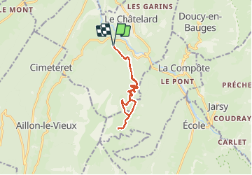
Trail Walking of 12.5 km to be discovered at Auvergne-Rhône-Alpes, Savoy, Le Châtelard. This trail is proposed by ranchoup.

Description

Belle rando de printemps.
Au départ de Montlardier, prendre la route forestière sur un peu plus de 3 km :  belle partie en forêt pour s'échauffer en pente douce.
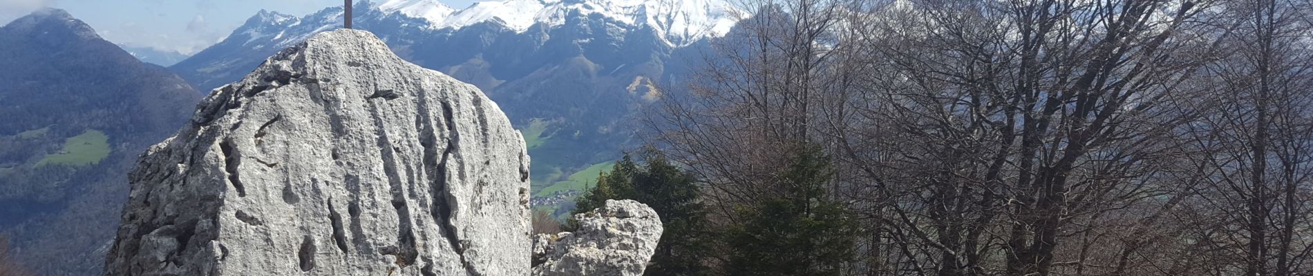
Suivre ensuite le sentier (marque jaune et vert) qui monte de façon plus soutenue jusqu'à la Croix du Plane. Beau panorama, ça vaut le coup de monter encore en suivant le chemin d'alpage jusqu'à Sur l'Arpette, pour découvrir tout le panorama .
A la redescente, on peut aller voir le joli chalet d'alpage Chaffard.

Elevation profile

Photos

Positioning

Country:
France
Region :
Auvergne-Rhône-Alpes
Department/Province :
Savoy
Municipality :
Le Châtelard
Location:
Unknown
Start:(UTM)
276223 ; 5062237 (32T) N.


Close
My subscriptions