


islelaurance

pjoly
User
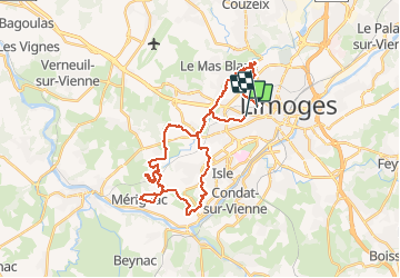

Length
33 km

Max alt
334 m

Uphill gradient
615 m
Km-Effort
41 km

Min alt
226 m

Downhill gradient
619 m
Boucle
No
Creation date :
2021-05-05 06:49:37.745
Updated on :
2021-05-05 19:37:35.197
12h47
Difficulty : Very difficult

FREE GPS app for hiking
 SityTrail
IGN / Geographical institutes
SityTrail Plus
The world is yours!
About
Trail Mountain bike of 33 km to be discovered at New Aquitaine, Haute-Vienne, Limoges. This trail is proposed by pjoly.
Positioning
Country:
France
Region :
New Aquitaine
Department/Province :
Haute-Vienne
Municipality :
Limoges
Location:
Unknown
Start:(Dec)
Start:(UTM)
363169 ; 5076671 (31T) N.
Comments